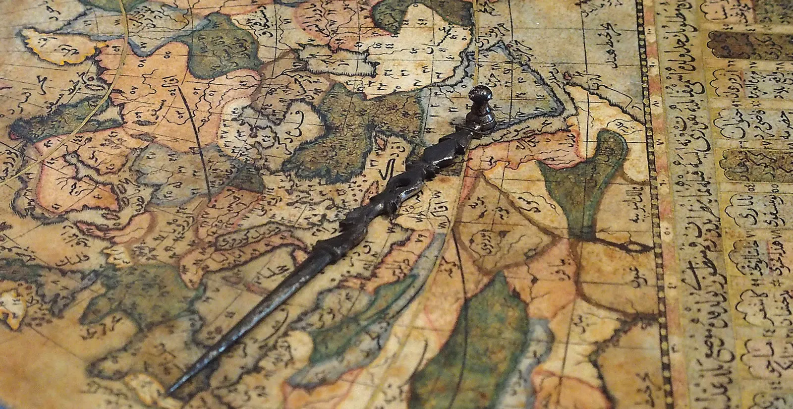
2020 Calendar: Exploring Islamic Maps
2020 Calendar: Exploring Islamic Maps
The richest surviving heritage of premodern maps of the world comes to us from the Middle East and Central and Inner Asia.
From the Babylonian clay tablet of 600 BCE to Katip Çelebi’s map of Japan drawn in 1732, geographers and cartographers of the Islamic world drew upon Greek, Babylonian, Syriac, Sassanian, Indian, Chinese, Turkic and European knowledge to produce a new, atlas-like genre of detailed maps of the world known to them. Until recently these maps lay virtually untouched, often ignored on the grounds that they are not mimetically accurate representations of lands and seas.
This perspective overlooks the great contribution of Islamic maps to the development of the history of cartography. The maps show how Muslims perceived the world from the time of the first civilizations until the late Renaissance. The abundance of copies produced in many places across the Middle East, North Africa, Anatolia and Central Asia over a millennium testifies to the enduring importance of these cartographic visions—as laid out in this resplendent calendar of images, medieval Islamic and Ottoman.
Starting in January with the famous Babylonian clay tablet, we see on display the concern with mapping the lands of Mesopotamia, its empires, rivers and sea. Beyond lie mysterious triangular islands shrouded in the mist of myths about Gilgamesh and others. All are encircled by a conjoined ocean, known as the Bahr al-Muhit (Encircling Ocean), which was the most basic marker of world maps up through medieval periods. For many Muslims, it held the footprint of the throne of God cited in the Qur’an, and it thus became a divine band protecting the world.
With the start of the caliphate and the conquests of the mid-seventh century, we hear of commanders commissioning maps for military and jizya (poll-tax) purposes, but none of these are known to have survived the passage of time. The earliest-surviving examples of Islamic mapping comes in fresco form, from an early-eighth-century Umayyad hammam, the unesco World Heritage site of Qusayr ‘Amra, a desert retreat of the prince and future caliph al-Walid ii. Tucked away in the sand and sun of the desert that separates Jordan from Syria and Iraq, the hammam is capped with a painting of a Ptolemaic star fresco. Less well known is the earliest-surviving mimetic depiction of the moon: At the entrance to the hammam, this small image precedes the earliest-known European efforts by at least seven centuries. February lays out this moon map of Qusayr ‘Amra with a special focus on georeferencing, for comparison, a contemporary image of the moon.
The abundance of copies produced in so many places over 1,000 years testifies to the importance of Islamic-world cartographic visions.
With March we get one of the earliest-known maps depicting the Nile. This is also an example of one of the earliest Islamic maps produced on paper. This one was part of an 11th-century manuscript copy of al-Khwarizmi’s Kitab surat al-‘ard (Book of a picture of the earth) published in English under the title The Oriental Geography of Ebn Hawqal (1800). Al-Khwarizmi shows how the Nile emerges from the mythical Mountains of the Moon (now Ethiopia), flows through multiple cataracts and heads north, crosses the equator to pass through the lands of Nubia, Aswan and Beja toward Fustat (medieval Cairo) and finishes in the Nile Delta near Dumyat (Damietta), where it empties into the Mediterranean Sea. Cartographers replicated this depiction of the Nile in various ways in every cartographic manuscript thereafter for centuries. As copies proliferated throughout the medieval Islamic Middle East, this helped establish what became, in effect, the world’s first geographical atlas series.
The maps pictured for the months of May and August are by different authors from that “Islamic atlas series” spawned by al-Khwarizmi. May shows the exceptional, three-folio map of the Mediterranean Sea from a late-11th-century copy of Ibn Hawqal’s Kitab surat al-‘ard. It is the earliest-known copy of the most-mimetic map of the Mediterranean. On it one can see the outlines of the Iberian Peninsula, the Calabrian Peninsula, the Peloponnese, Constantinople, the Bosporus, southeastern Anatolia, the Levant, Egypt and North Africa; it shows key cities, mountains and rivers, along with major islands of the Mediterranean.
August displays two magnificent maps from Leiden University Library’s regally sized and lavishly illustrated Ms. Or. 3101. One shows the province of Sindh, with the Indus River running across the land of Buddha and Hind to al-Mansura (present-day Multan) and the land of medieval Sindh before emptying into the Indian Ocean. The second map depicts the Caspian Sea between the mountains of Daylam and Samarkand along what was then the central Silk Road. These are among the earliest examples of al-Istakhri’s Kitab al-masalik wa al-mamalik (Book of routes and realms), which dates from 1193 CE. Al-Istakhri’s geography went on to become the most heavily copied work of the Islamic atlas series, with copies surfacing even from mid-18th-century Mughal India. Depicting a highly stylized world of symbolic shapes, the manuscript was likely produced as a wedding gift for Constance, daughter of Norman King Roger ii. It was perused by many a European dignitary, including and especially Constance’s son, Holy Roman Emperor Frederick ii.
Al-Khwarizmi’s map of the Nile became a model for depicting the river in nearly every cartographic manuscript for centuries.
June also reflects Sicilian-Norman influence, this time with the earliest map depicting medieval Sicily, which was found in the recently discovered 13th-century copy of the Book of Curiosities manuscript. It lays out Sicily’s key cities of Palermo, Messina, Syracuse and Trapani so clearly that it could have served as a conqueror’s roadmap.
Rounding out the symbiotic intellectual relations of Muslims and Christian Normans in Sicily, September shows the work of the Arab cartographer best known in the West, al-Sharif al-Din al-Idrisi. In the mid-12th century, King Roger ii commissioned al-Idrisi to produce an illustrated geography of the world called Kitab nuzhat al-mushtaq fi’kh tiraq al-afaq (The book of pleasant journeys into faraway lands). The 70 individual maps that accompany the copies of al-Idrisi’s manuscript are extremely detailed representations of the world, well ahead of their time. Not only are the al-Idrisi maps ranked among the most mimetic world maps of the later Middle Ages, but they also include regional maps that show an astounding understanding of topography for the 13th century.
April takes us to Inner Asia, to the start of Turkic influences, with a rare and very early map from the late-11th-century ce Arabic-Turkic dictionary Diwan Lughat al-turk (Compendium of the Turkic Dialects). It presents an Inner Asia-centric view of the world, with Turkic tribes dotted all around. The date and style of this map leave us wondering whether Turks brought the world-envisioning mapping tradition to the Middle East from their vantage points atop the high steppes.
Through the Ottomans, Turkish influences dominate the second half of the history of Islamic mapping, beginning with October’s sample of the unique, bird’s-eye topographical views that the 16th-century cartographic illustrator Matrakçı Nasuh developed to depict the territorial passages of Ottoman military campaigns. Each image from Nasuh—in what could be described as the first attempt at 3D—is a visual feast. We chose to show Nasuh’s image of Baghdad—its earliest-extant city view.
November depicts the legendary portolan chart map fragment credited to Ottoman naval admiral Piri Reis, who was born in 1470 and died in 1554. The subject of many controversial studies, the Piri Reis map shows astonishingly accurate coastlines not only for Central and South America but also Antarctica.
Nasuh’s cartographically illustrated histories could be described as the first attempt at 3D.
December depicts Katip Çelebi’s map of Japan, which effectively signals the close of Islamic cartographic originality, as copies and techniques of European atlases take center stage in the field. While translating Gerardus Mercator’s Atlas Minor into Ottoman Turkish in 1653–1655, Çelebi also made copies of Mercator’s maps, which he labeled in Ottoman Turkish.
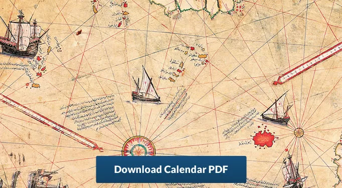
There is yet one distinctively Islamic cartographic-copying tradition that continues even into the modern era: the depiction, in cartographic forms, of the holy cities of Makkah and Madinah, as shown in July’s Hajj certificate scroll map. Often elaborately illuminated in gold, these scrolls certify the holder’s completion of Hajj, or pilgrimage.
Together, all of the maps produced over this unfathomably long era share one thing in common: They were made on the basis of sketches, accounts and myths; views from hills, mountains and the masts of ships; supplemented by tradition on the one hand and carefully accumulated data from increasingly sophisticated navigational and geometric tools on the other. Although these maps do not display the forms of the world in the way ours do today, modern atlases and GPS maps turn out to have much in common with the maps in this calendar: Systems of shapes, lines, labels, patterns and colors all help us understand the world and invite us to explore it.
About the Author
Karen C. Pinto
Karen C. Pinto has researched medieval Islamic maps in collections around the world for three decades. She is author of Medieval Islamic Maps: An Exploration (University of Chicago Press, 2016), which in 2017 received an Outstanding Academic Title (OAT) award from Choice magazine. She holds a Ph.D. from Columbia University, was a 2013–14 National Endowment for the Humanities Fellow and a 2016 recipient of the Franklin Grant. Her own image collection of more than 3,000 Islamic maps contains many previously unpublished.Paul Lunde
The late Paul Lunde authored more than 60 articles for AramcoWorld. He was a senior research associate with the Civilizations in Contact Project at Cambridge University and also co-author, with Caroline Stone, of Ibn Fadlan and the Land of Darkness: Arab Travellers in the Far North (Penguin, 2012).
You may also be interested in...
AramcoWorld: Celebrating 75 Years of Global Historical Insight
History
Cover stories that bridge the past and present offer insights into humanity’s common ground. From archeology to historical objects, people, places and more we share connections to one another.
How California's Date Fruits Became America's Arabian Superfood
Food
History
In recent years in the United States, dates have been trending as a nutrient-dense, easily transportable source of energy. Nearly 90 percent of US-grown dates are from California’s Coachella Valley. Yet the date palm trees from which they are harvested each year aren’t native; they were imported from the Arab world in the 1800s. Over the years, they have become a part of Coachella’s agricultural industry—and sprouted Arab-linked pop culture.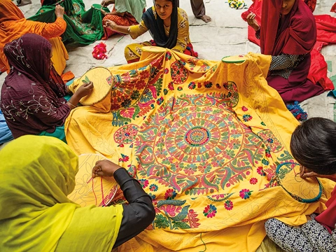
Nakshi Kantha Embroidery: Tales of Heritage and Revival
Arts
History
A traditional form of quilting in Bangladesh in which women embroider family history, love and memory into the fabric is blanketing markets locally and beyond.