Boundaries: Rethinking the Mapping of Jerusalem Into Quarters
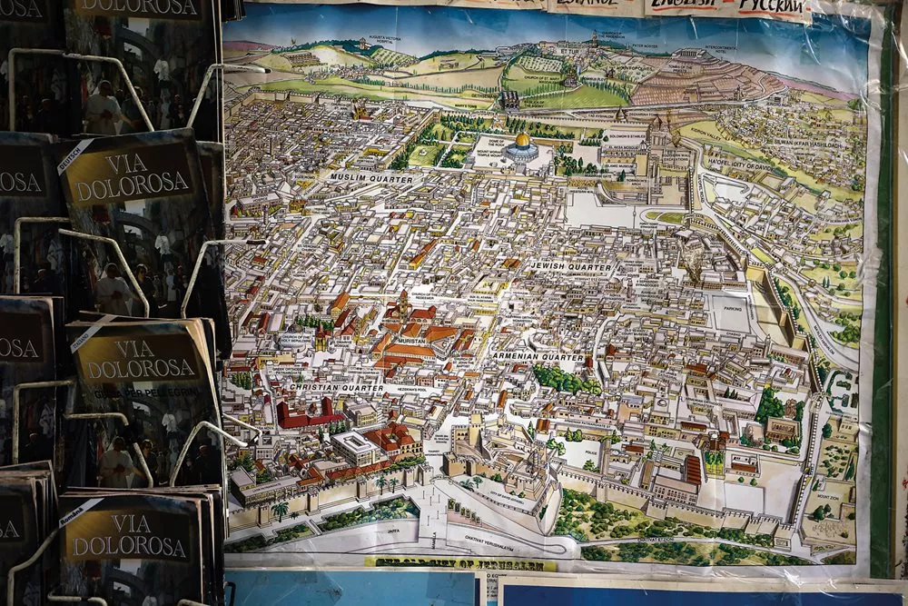
Nearly all modern maps of Jerusalem’s Old City show it divided into four quarters labeled Christian, Muslim, Armenian and Jewish. But the idea that gave rise to these labels dates back only to the mid-19th century and surveys of the city by colonial mapmakers—and specifically to the pen of a young British chaplain.
“Among ourselves, we don’t say it. ‘Where are you going?’
‘I’m going to al-Wad Street,’ ‘I’m going to al-Aqsa,’ ‘I’m going to the market,’
‘I’m going to the Redeemer church,’ not ‘I’m going to this quarter or that quarter.’
The notion of ‘Muslim Quarter’ is absent from our daily language.”
—Mustafa Abu Sway
Maps of Jerusalem show the Old City divided into four: top left Christian Quarter, top right Muslim Quarter, bottom left Armenian Quarter and bottom center Jewish Quarter. Such neat divisions.
Nearly all modern maps do this. Many are even color coded, with blocks of shading for each quarter and precise borders marking frontiers from one quarter to the next. But it’s no surprise to learn that in reality no city functions like this.
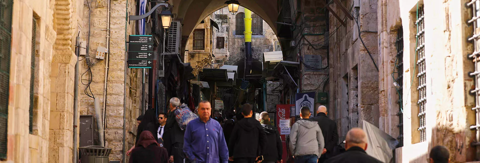
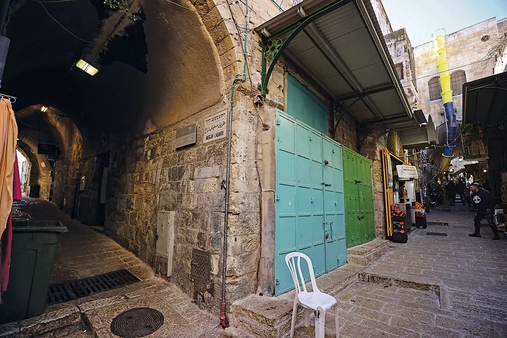
The busiest of Jerusalem’s lanes is Suq Khan al-Zeit. Suq means market, a khan is a caravanserai, and zeit is oil, specifically olive oil. For hundreds of years, into the 20th century, this crowded street was lined with workshops where olives would be pressed and the oil stored for sale or processed into soap.
And nobody knows which “quarter” it’s supposed to be in. Most maps say it’s in the Muslim Quarter, but then again it has chapels, it includes part of the Via Dolorosa—the centuries-old Christian pilgrimage route—and it leads directly to the Church of the Holy Sepulchre. Some maps treat Khan al-Zeit as a dividing line, with the east side of the street counting as the Muslim Quarter and the west side as the Christian Quarter. Does that make the apricot I dropped one day in the middle of the street a Muslim apricot or a Christian one?
More problems arise. The “four quarters” configuration leaves out the Haram al-Sharif, or Noble Sanctuary, one of the names for the al-Aqsa mosque compound, but the Haram is almost always shown as a neatly walled-off rectangle, visually separated from the rest of the Old City. Is the Haram inside the Muslim Quarter, or not? Visitors might imagine it is some kind of fifth quarter.
It’s not, of course. The Haram al-Sharif is an Islamic space, intimately linked with the lives of the people who live within and around its perimeter—as well as countless more distant others—in ways that belie hard lines on a map. As the writer Ahdaf Soueif put it, “The north and west walls of al-Aqsa are not walls at all; they are a porous urban border that houses people, schools, libraries and archives.”
The idea of the four quarters is not old. It dates from the 19th century. But if you’re approaching Jerusalem for the first time, you might assume that the four quarters (or are there five?), and their attribution to specific religious communities, are, somehow, holy. A holy city, divided into holy quarters. From that mistake, it’s a short step to the next: thinking that, for example, only Christians live (or perhaps could live) in the Christian Quarter.
From that double mistake, it would be easy to absorb the unspoken message that you, an innocent visitor, might be more welcome in one quarter than another. Seeing all these zones of religiousness on the map, you might conclude that you should just stick tight with your own people, whoever they happen to be, for safety and so as not to unwittingly offend anyone else.
And that is a falsehood worth debunking.
For more than 1,000 years, almost every map of Jerusalem was figurative or purely imaginary, a symbolic representation of an idealized location. In medieval Europe, as in the Islamic world, the idea of a map wasn’t so much to function as a practical aid, since travelers would journey with knowledgeable guides. Often, maps were drawn after travel, to serve as a rendering of how an individual or community conceived of a place. What Jerusalem looked like, or where it was, mattered far less than what it represented—a place of perfection, the point of connection between heaven and Earth. A map became a visual expression of religious belief.
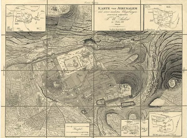
On his 1849 map, Williams largely ignored most local names of streets and places.
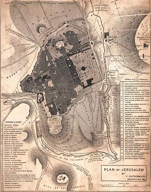
The next major advance was a map by the English explorer-architect Frederick Catherwood, published in 1835. It isn’t quite right—Catherwood gets a bit mixed up in the smaller alleys—but the detail is absorbing. As before, there is no mention of quarters apart from “Jews Quarter.”
It was two years later, in 1837, that the first map showing the presence of ethnoreligious quarters appeared. Viennese lithographer Hermann Engel translated Catherwood’s work into German but introduced variations in typography to differentiate geographical features from ethnoreligiously defined districts. Engel’s Jewish Quarter is marked in a lighter typeface that he also uses for a Latin Quarter, Greek Quarter, Turkish Quarter and Armenian Quarter. This is the first time any of these names appear on a map.
On what did Engel base this innovation? Did he go to Jerusalem himself, or was he just printing a map from another source? Almost nothing has been written about his work.

It need not imply exactly one-fourth, though that meaning has a solid foundation in Latin. Roman urban design often involved the division of a military camp into four by the creation of a straight north–south road intersecting with a straight east–west road. Such military echoes survive in modern English, which has “married quarters,” “headquarters,” “quartermaster,” to “give no quarter.” This usage slid into civilian life—every grand house once had its servants’ quarters—though the undertone remained.
Quarter in the sense of a city district still seems to survive in a gray area. Particularly with Jerusalem, outsiders expect it to reflect a precise division into four. Yet other cities get by fine with fewer. New Orleans has only one—the French. Paris has a Latin Quarter and a few others. Many European cities have, or had, a Jewish Quarter. Birmingham in England has Chinese and Irish quarters, and a Jewellery Quarter, named for its artisans. There’s an Indian Quarter in Durban.
This hints at the word’s nuances of power, drawn from military origin, class hierarchies and cultural, nationalistic or ethnoreligious separation: When English uses “quarter,” it generally means a place where “other people” live.
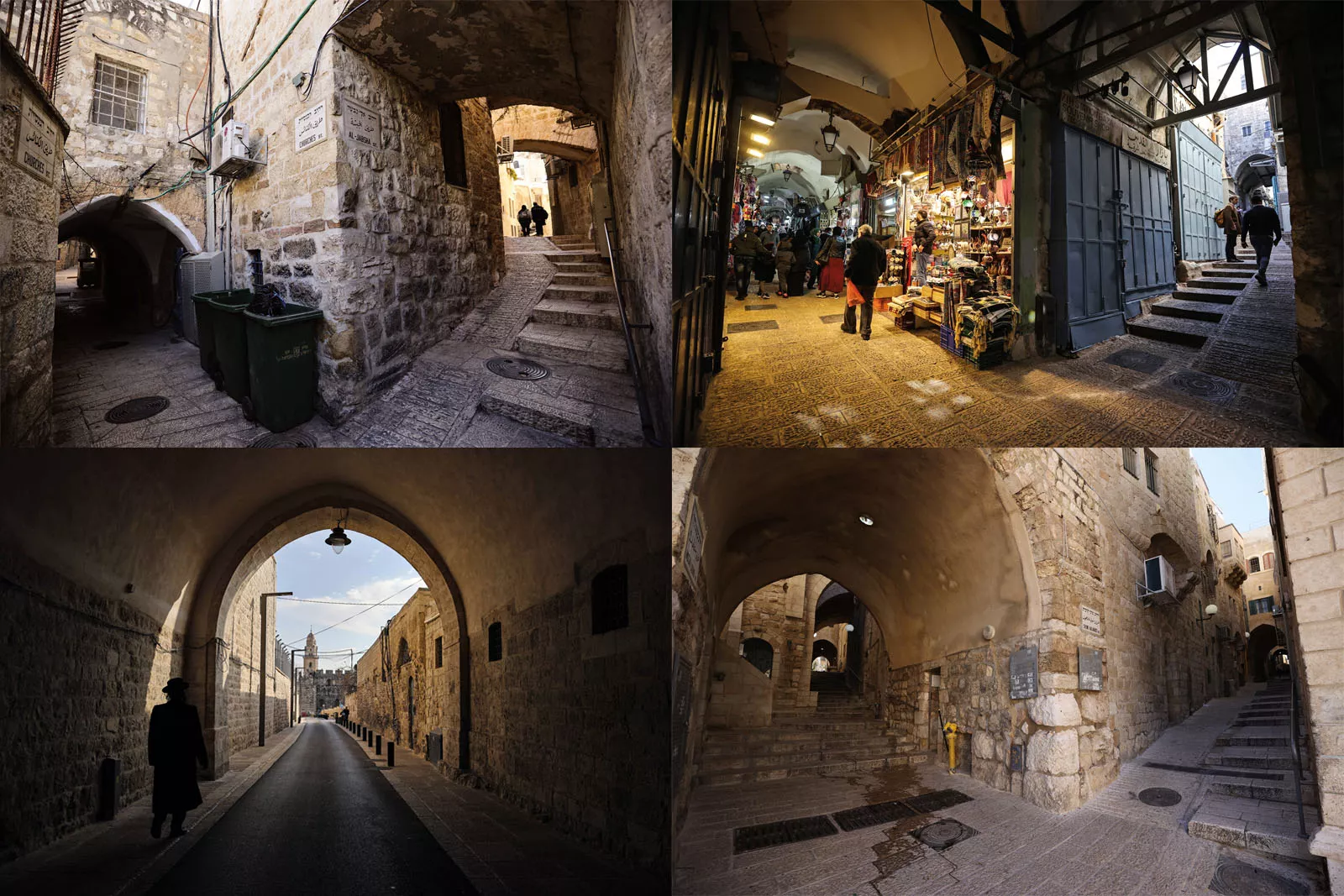
Arabic has a completely different conceptual framework. In the Jerusalem context, the most important term is hara, which can also be transliterated in colloquial constructions as haret (plural harat). A hara can be both a street and a small neighborhood, often at the same time: The one lends its name to the other. It carries none of the baggage burdening the English word “quarter.”
Several harat could comprise a hayy, meaning district. Several of these, forming a large area in a big city, could be termed rub’a, literally a quarter. But such definitions are slippery. What’s clear from listening to people, and as one Jerusalemite, the writer Khalil Assali, confirms, “Palestinians never use rub’a. Some people say ‘hayy,’ but that’s new. Everybody still uses ‘hara.’”
In 1495 Jerusalemite historian Mujir al-Din identified 18 harat in his city. Another count has identified 39 quarters in Jerusalem during the 13th and 14th centuries. By the 19th century, some had changed or disappeared, but many persisted, and others emerged. Haret Bab Hutta comprised, as it still does, the network of alleys running off the street that emerges from Bab Hutta (Gate of Forgiveness), the middle gate in the north wall of the Haram al-Sharif. Haret as-Sa’diyya was named after the Bani Sa’d tribe. There was Haret Haddadin, named for a tribal grouping of Christian Arabs; Haret al-Mawarneh, named for Maronite Christians; Haret al-Qattanin, the Cotton Merchants; Haret Khan al-Zeit, the Olive Oil Caravanserai; Haret al-Magharba, the North Africans; Haret al-Wad, beside Al-Wad Street, and several more.
Populations across the city remained mixed. Christians gravitated to the area around the Church of the Holy Sepulchre in the west of the city. Muslims often settled in the north and east, close to al-Aqsa Mosque. Jews tended to settle close to the Western Wall in the south. But these patterns were neither fixed nor exclusive. There used to be a Jewish quarter in the northeast. Many churches thrive today in areas framed as Muslim, such as St. Anne’s, a Roman Catholic church beside the Haram al-Sharif. The Muslim area of Haret al-Magharba lay beside the Jewish holy place of the Western Wall. By around 1900, more than a third of Jerusalem’s Muslims lived outside the “Muslim Quarter,” and both Christians and Jews lived inside it. There were non-Armenian Christians in the “Armenian Quarter,” Jews in the “Christian Quarter” and Muslims in almost every part of the city.
Jerusalem had—and still has—a multitude of neighborhoods. All throughout its long, long history, it was never divided into four, neat, religious quarters.
Until the British arrived.
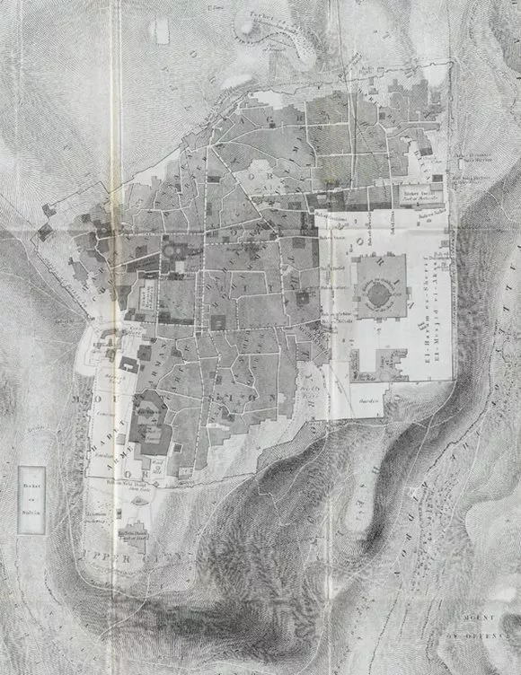
To tell this part of the story we need to return to the 1830s—for Jerusalem, a time of political upheaval. Following invasion, a popular uprising and a change of sultan in Constantinople, the Ottoman Empire was apparently about to collapse. The European powers scrambled to reimpose order, seize influence and, in Britain’s case, keep routes open to colonial possessions farther east in India. They also identified a power vacuum in Palestine. The first British Consulate opened in Jerusalem in 1839, and military intervention left a group of British officers stationed in Palestine to survey terrain. Two of them—Edward Aldrich and Julian Symonds—arrived in Jerusalem in March 1841.
The map they produced superseded Catherwood’s, forming the basis of cartography in the city for decades afterwards, not least for its labeling. Because here, newly arcing across the familiar quadrilateral of Jerusalem, are four double labels in bold capitals. At top left Haret En-Nassara and, beneath it, Christian Quarter; at bottom left Haret El-Arman and Armenian Quarter; at bottom center Haret El-Yehud and Jews Quarter, and at top right—the big innovation, covering perhaps half the city—Haret El-Muslimin and Mohammedan Quarter.
No map had shown this before. Every map has shown it since.
The idea, in 1841, of a “Mohammedan” (that is, Muslim) quarter of Jerusalem is as bizarre as a “Catholic Quarter” of Rome. Or a “Hindu Quarter” of Delhi. Nobody living there would conceive of the city in such a way. At that time, and for centuries before and decades after, Jerusalem was, if the term means anything at all, a Muslim city. Many people identified in other ways, but large numbers of Jerusalemites were Muslims, and they lived all over the city.
A Muslim quarter could only have been dreamt up by outsiders seeing what they wanted to see.
But it may not have been Aldrich and Symonds.
Below the frame of their map, printed in italic script, a single line notes that “The Writing” had been added by “the Revd. G. Williams” and “the Revd. Robert Willis.”
The first Protestant bishop of Jerusalem, Michael Alexander, had arrived in Jerusalem in January 1842. Chosen to accompany him as chaplain was George Williams, aged only 27. Williams stayed just over a year before departing to Russia, Ireland and other postings, but he became Aldrich and Symonds’s champion, adopting their map—which had been published first in 1845 in plain form—and reproducing it in full in 1849 in his book The Holy City.
Did Aldrich and Symonds invent the idea of four quarters? It’s possible, but they were military surveyors, not scholars. It seems more likely they focused on producing a usable street-plan for their superior officers. The 1845 publication, without street names, quarter labels and other details, suggests that.
It’s the 1849 publication we need to focus on.
Populations across the city remain mixed in patterns that are neither fixed nor exclusive.
The other named figure, Reverend Robert Willis, was a Cambridge University professor of mechanical engineering who dabbled in architectural history. He never went to Jerusalem.
So we come back to Williams. In The Holy City, he takes it upon himself to “assign names” to Jerusalem’s main streets, since “the inhabitants have, for the most part, dispensed with ... this convenient practice.” This is false, as we’ve already seen: The inhabitants had names for every corner. Williams largely ignores contemporary Arabic and instead uses English names last used by the Crusaders. He has “Street of the Temple” for Bab al-Silsila (Street of the Chain); “Street of the Arch of Judas” for Haret al-Yahud (Street of the Jews); “Street of Saint Stephen” for Khan al-Zeit. These are names that were centuries out of date.
Compounding his anachronisms, and perhaps with a nod to Roman urban design, Williams wrote wrongly how two main streets “divide Jerusalem into four quarters.” Then the crucial line: “The subdivisions of the streets and quarters are numerous, but unimportant.”
Williams too saw what he wanted to see. With Britain’s increased standing in Palestine, and the growth of interest in biblical archaeology, it was vital for the newly arrived missionaries to establish boundaries. They needed to know exactly who lived where, to target their evangelizing efforts. As British newcomers did in India and other colonies, they imported their home-grown conceptions of social division.

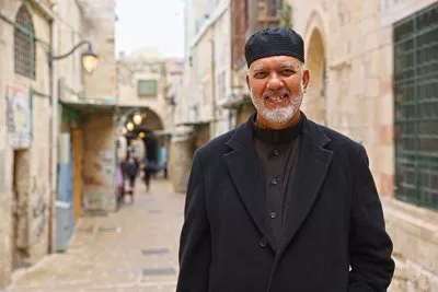
“We never use ‘Muslim Quarter’ in Arabic,” Mustafa Abu Sway, professor of Islamic Studies at al-Quds University, says. “I am more than 60 years old, and I have never used that term except in an academic setting and media interviews. Among ourselves, we don’t say it. ‘Where are you going?’ ‘I’m going to al-Wad Street,’ ‘I’m going to al-Aqsa,’ ‘I’m going to the market,’ ‘I’m going to the Redeemer church,’ not ‘I’m going to this quarter or that quarter.’ The notion of ‘Muslim Quarter’ is absent from our daily language.”
Laura C. Robson, a historian of colonialism, concurs: “[The] evangelical Protestant worldview did a great deal to determine the nature of the encounter between the British and the local Arab populations ... in 19th-century Palestine. It determined the British focus on local Christian and Jewish populations, rather than the much larger Arab Muslim community. Furthermore ... it assisted the emergence of an understanding of Palestine as a place whose significance lay primarily in its Christian and Jewish heritage—an idea that would be used from the mid-19th century onwards to legitimize a British political claim to the so-called ‘Holy Land.’”
Thus was a Muslim Quarter created.
The four quarters took hold in outsiders’ imaginations. They appeared, reinforced in bold lettering, on maps throughout the 19th and then the 20th centuries.
If George Williams’s framing, and the fostering of sectarian division it codified, hadn’t suited the British and other European governments, such cartographic fantasy would never have persisted. The fact that it has, to the extent that it’s now all over the internet and available for free at every tourist office, speaks volumes about the colonial ambitions of successive waves of Jerusalem’s rulers, down to our own time.
“Religious, ethnic and racial difference underpinned European conceptions of state and society, and ethnographic maps became a tool of empire and nation-building,” wrote historian Michelle Campos. “The unease that European observers repeatedly expressed at the messy taxonomies of other heterogeneous Ottoman and Levantine cities such as Istanbul, Salonica, Izmir, Beirut and Jaffa ... contributed to a lasting desire to place Jerusalem’s residents in neatly sealed quarters.”
Jerusalemites lived—and live—in another Jerusalem. To take just one source, Jerusalemite musician Wasif Jawhariyyeh (1897–1972) wrote vividly about the shared experience of religious celebrations and the fluidity of inter-communal relations before British rule. “It is amazing to see how the huge festivals and wide national celebrations of each religion and every confession followed one another in peace and security,” he wrote. Palestinian historian Salim Tamari, who edited Jawhariyyeh’s diaries for publication, notes the absence of ethnoreligious demarcation lines at that time. Jawhariyyeh’s lived experience and Tamari’s analysis of it offer a compelling repudiation of the colonial world view presented by George Williams and his heirs.
And so today, wherever you see it, know that it is false.
This article is adapted with the author’s permission from Nine Quarters of Jerusalem: A New Biography of the Old City, by Matthew Teller. (Profile Books [UK], Other Press [US], 2022).
About the Author

Matthew Teller
Matthew Teller is a UK-based writer and journalist. His latest book, Nine Quarters of Jerusalem: A New Biography of the Old City, was published last year. Follow him on X (formerly Twitter) @matthewteller and at matthewteller.com.
Mostafa Alkharouf
Mostafa Alkharouf is a documentary photojournalist with the Anadolu Agency based in East Jerusalem whose work, focused on daily life in Palestine, has been published globally.
You may also be interested in...
How California's Date Fruits Became America's Arabian Superfood
Food
History
In recent years in the United States, dates have been trending as a nutrient-dense, easily transportable source of energy. Nearly 90 percent of US-grown dates are from California’s Coachella Valley. Yet the date palm trees from which they are harvested each year aren’t native; they were imported from the Arab world in the 1800s. Over the years, they have become a part of Coachella’s agricultural industry—and sprouted Arab-linked pop culture.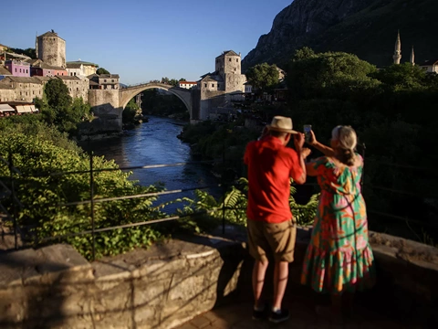
The Bridge of Meanings
History
Arts
There is no truer symbol of Mostar, Bosnia-Herzegovina, than its Old Bridge. The magnificent icon of Balkan Islamic architecture was destroyed during the 1992–’95 war—but not for long. Like the multicultural workforce that produced the original hundreds of years earlier, a broad team of architects, engineers and others came together immediately to plan its reconstruction. This summer marked the 20th anniversary of the bridge’s reopening.
AramcoWorld: Celebrating 75 Years of Global Historical Insight
History
Cover stories that bridge the past and present offer insights into humanity’s common ground. From archeology to historical objects, people, places and more we share connections to one another.